


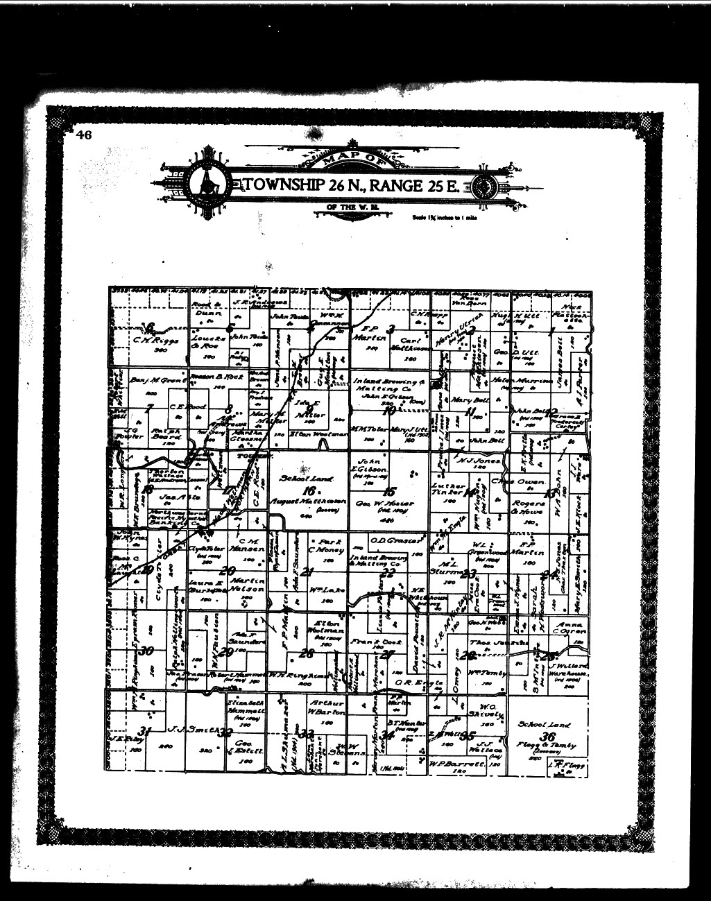
Township Map south of Mansfield T26N,R25E
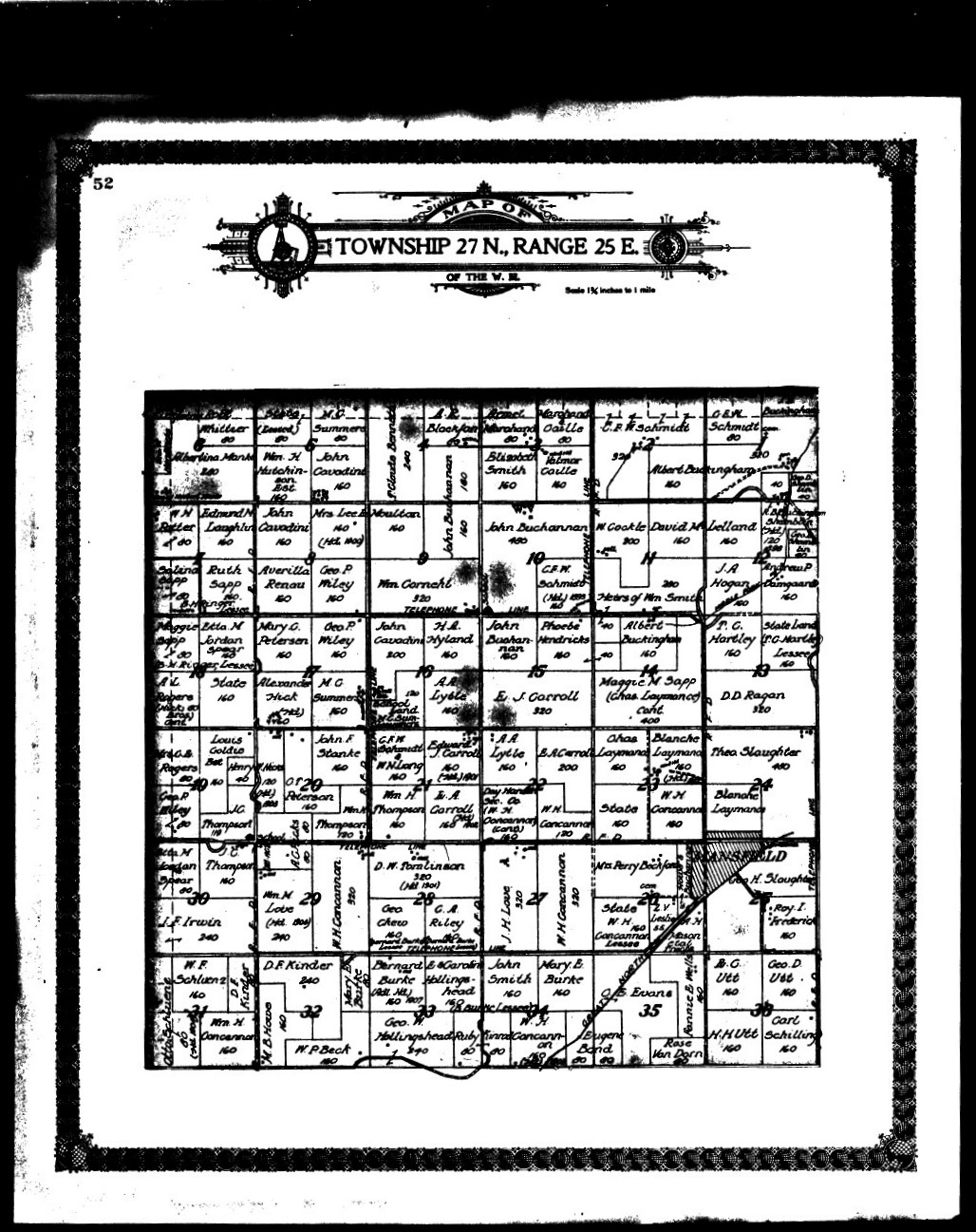
Township Map Mansfield area T27N,R25E
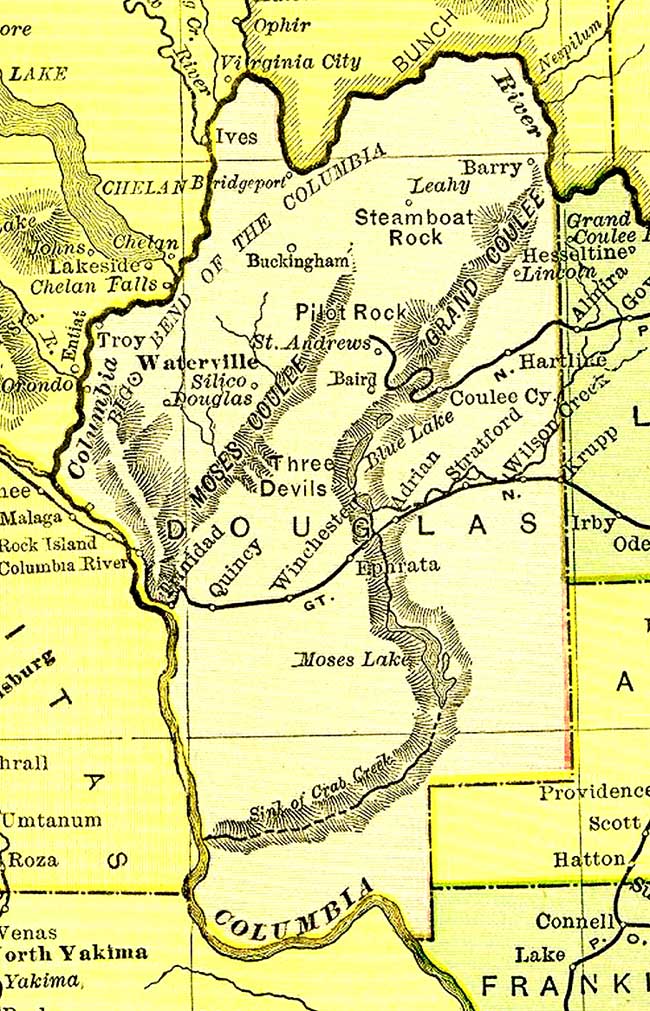
1915 Douglas County Historic Map Works
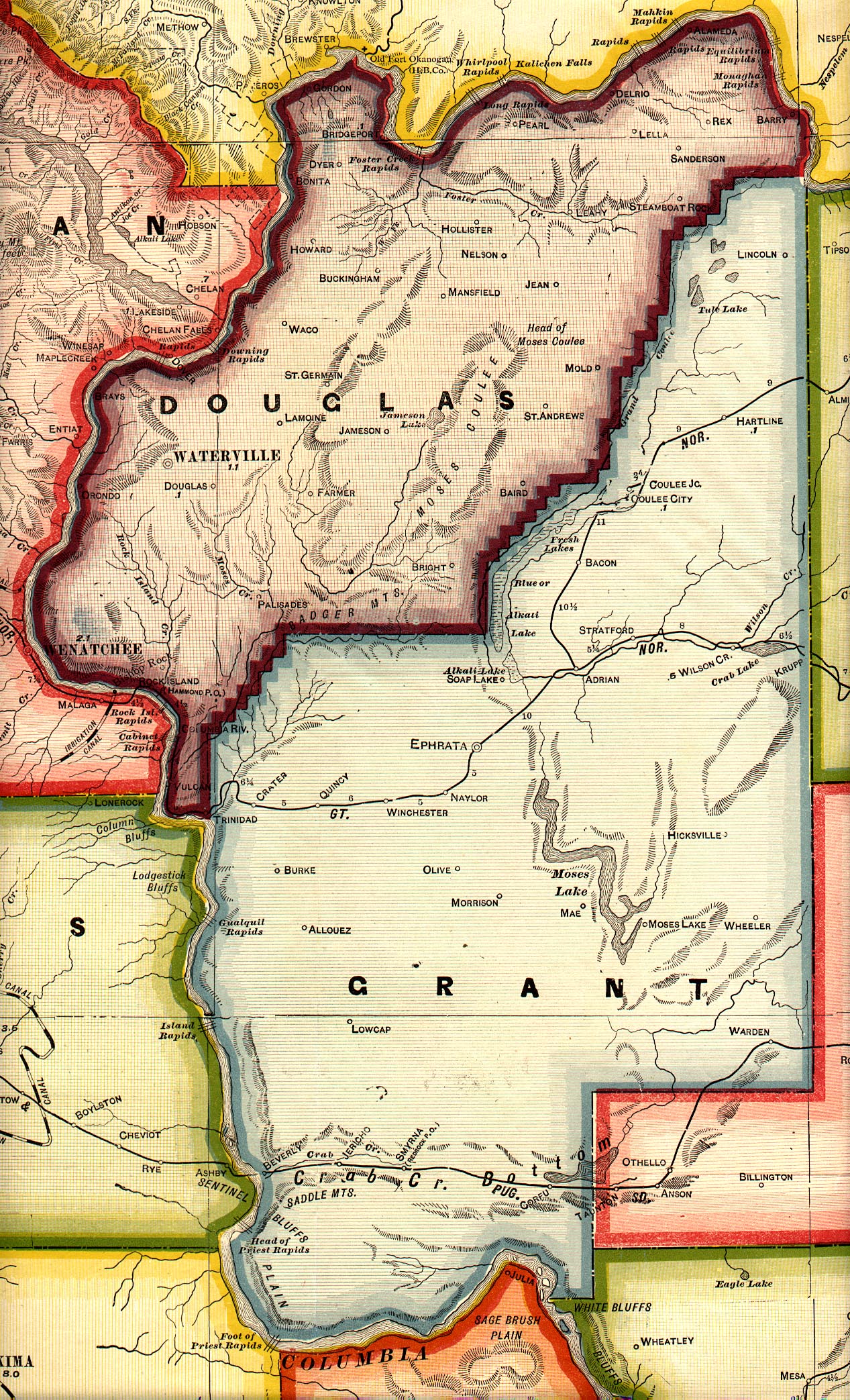
1916 Douglas County Road Map (from Secretary of State website)
Current map of Douglas County. Use control + scroll up/down to zoom in and out of map:
County Coordinator:
Shannon (Hill) Lanning
State Coordinator:
Mike Sweeney
Asst State Coordinator:
Colleen Pustola
If you have information, questions, comments, or any problems with this site, please do not hesitate to contact the County Coordinator. We are here to help.
